
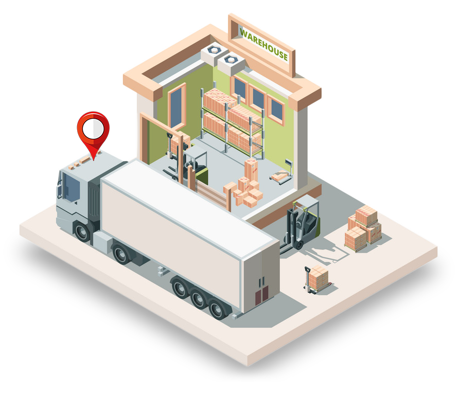
Perfect For Every Vehicle & Cargo
UltiVeTra is a tracker solution for vehicle & cargo, combining advanced hardware and software.
- Multi-GNSS, INS, ubiquitous & accurate tracking
- Secure, ubiquitous and cost-effective data communications
- Flexible, ubiquitous sensor support
- CAN bus interface for vehicle engine monitoring
- High processing and storage capacity for advanced processing
- Advanced power management and backup power
Multi Satellite System Support & Inertial Navigation
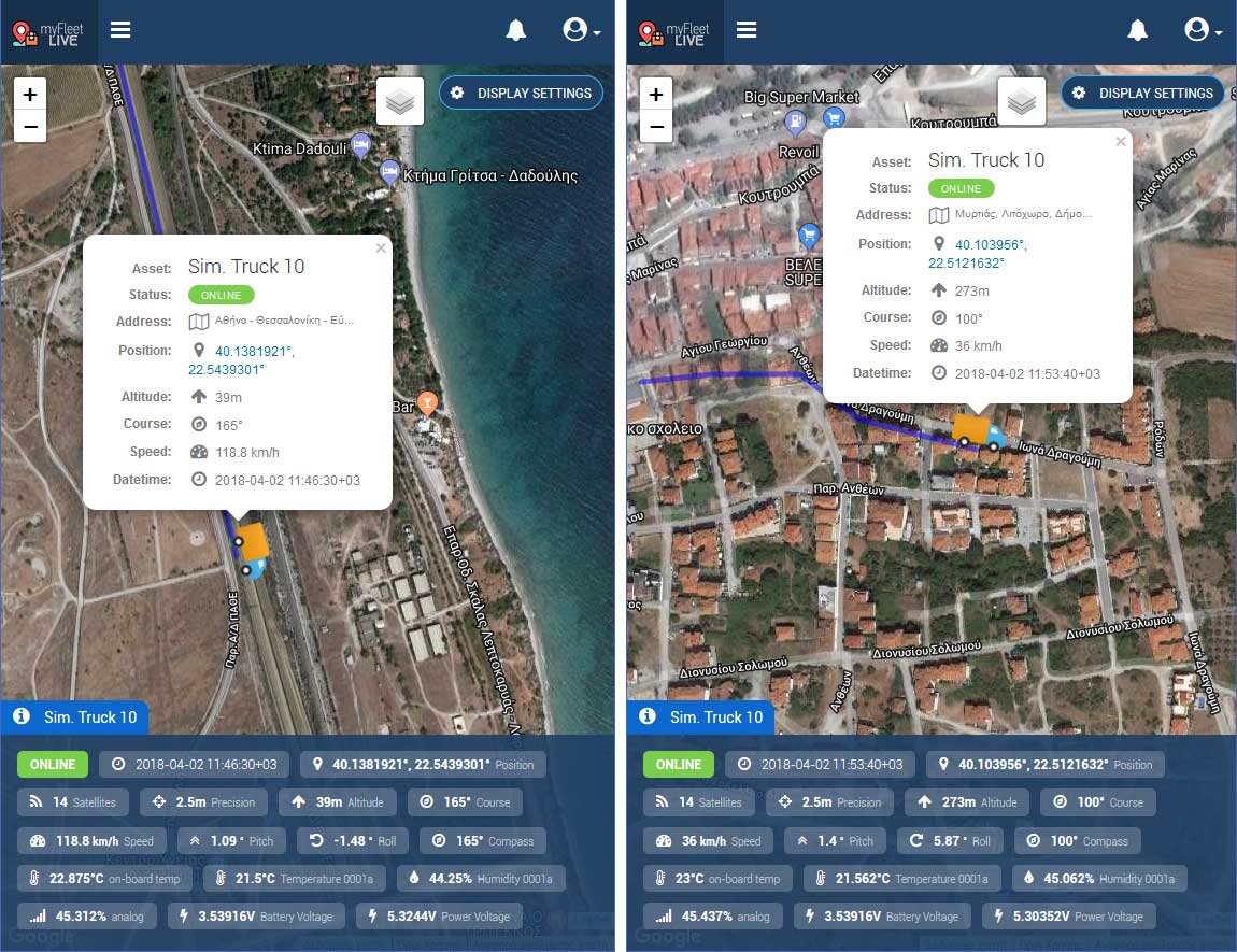
UltiVeTra uses Multi-GNSS (GPS, Galileo, GLONASS, SBAS, Q2SS, etc.), for higher position accuracy. 20+ satellites achieving a 1m-2m accuracy.
UltiVeTra also supports Inertial Navigation technology that allows more accurate positioning, even when satellite signal is poor (e.g. in tunnels and urban canyons).
Next: Hardware Components

High End Components
UltiVeTra's hardware main board is designed and developed by SBOING, combining high end components.
- Raspberry Pi Zero W
ARM1176 cpu Clock 1 GHz 512 MB RAM 40-pin GPIO 140 mA / 5V On-board WiFi On-board Bluetooth 1x USB port Storage: 16 GB SD OS: Raspbian Linux - Multi-GNSS + INS Receiver
32 ch. (GPS, GLONASS, Galileo, QZSS, SBAS) Untethered – no electrical connections to the car Real-time positioning update rate of up to 20 Hz RS-232 protocol - Cellular Communications Module
GSM / GPRS / 3G modem RS-232, AT commands - ATMEL AVR as a Protocol Adapter
Fully programmable Minimal external components Works as 1-Wire protocol converter for sensor interfacing - 9-axis Inertial Module
3D accelerometer 3D gyroscope 3D magnetometer - Satellite Modem by Rock7
RockBLOCK 9603 Iridium satellite modem Raspberry Pi / Arduino ready RS232 & USB connectivity - Power Management Unit
- Bluetooth Module
Your Data Available From Any Device, Anytime
UltiVeTra secures your data on cloud storage in real time or temporarily stores them locally when internet connection is not available.
UltiVeTra's data storage is based on cloud-based, IoT Services that are fully scalable, resilient, fault-tolerant and capable of big data analytics.
Access your data via our smartphone Apps for various Roles:
Consumer / Producer / Logistics (manager, driver)
The Fleet Monitoring Web Platform (MyFleetLive.net) supports multiple Companies for fleet monitoring, fleet asset management and for sensourcing & alerts.
Next: Fleet Monitoring Web Platform
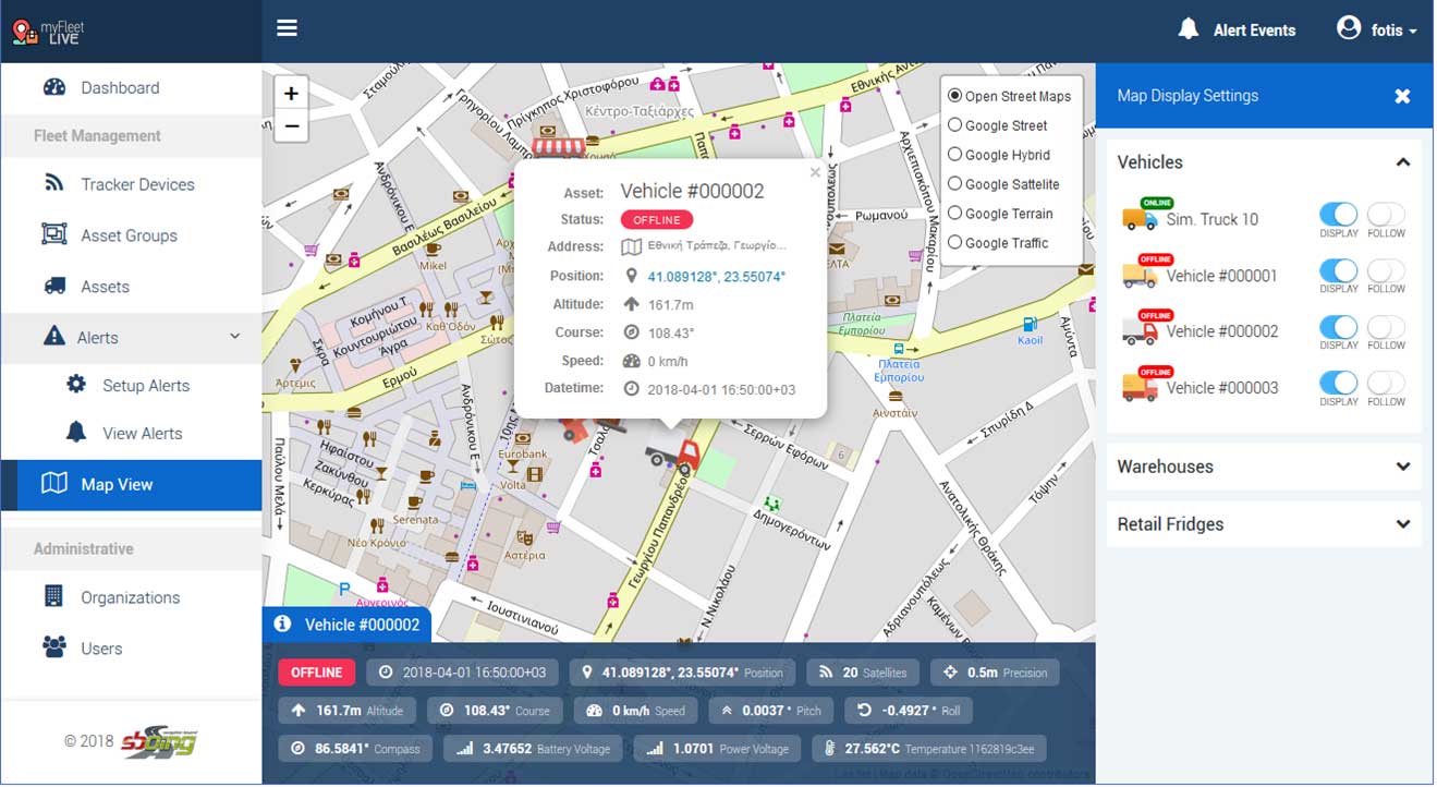
Feature-rich fleet management platform
MyFleetLive.net
- Supporting multiple Companies
- For fleet monitoring & fleet asset management
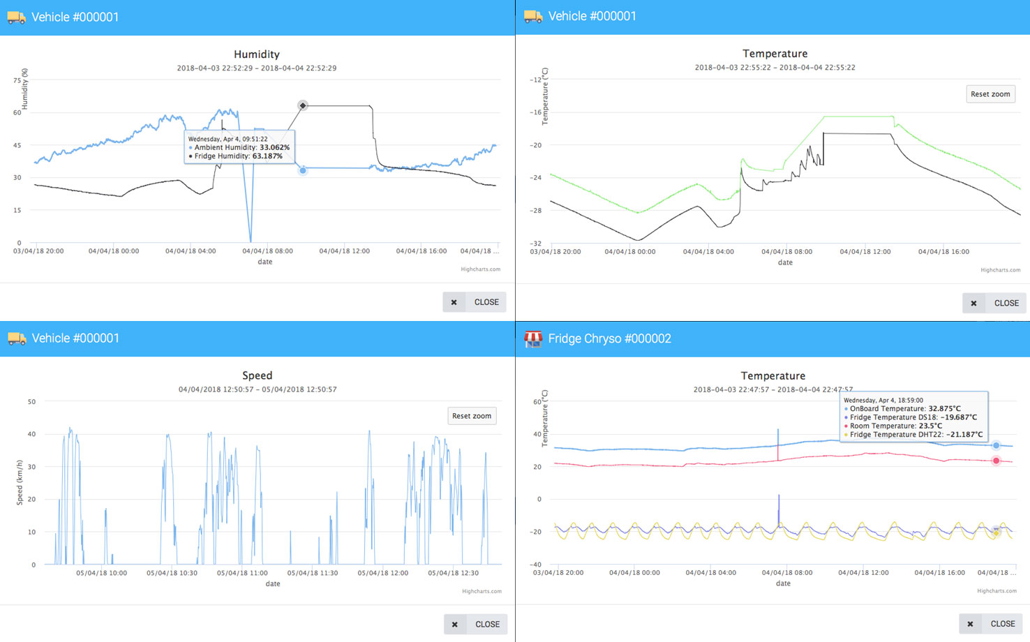
- For Sensourcing & alerts
MyFleetLive™ also enables transportable, consumable and perishable products or dangerous cargo to “tell” their whole-journey experience from production to consumption, through the monitoring and collection of sensor data (called “sensourcing”) from all freight legs. Using sensors installed in the vehicle, the transport conditions are recorded. Then quality indicators are computed and associated with every single transported product.
Live Demo: MyFleetLive.net PlatformFleet Management Platform Features
Cloud Based Tracking
Our cloud-based GPS Tracking platform stores all of your vehicles’ location and critical data on the cloud for you to access it whenever should you require.
Usage Reports
Users can generate or schedule usage, mileage and driver behavior reports. Usage reports allow businesses to lower their expenses and optimize their fleet.
Trip Logging
Trip Log enables business owners to identify business and private uses of vehicles allowing them to distinguish mileage done by company vehicles for tax reimbursements.
Global Coverage
We offer global tracking and coverage, our trackers will pick up the best signal in 150 countries and there are no extra roaming charges or fees when you travel abroad.
Alarms & Notifications
Users can set up alarms to get instantly notified when a vehicle; speeds, enters or leaves an area, used out of work hours or if the tracker is disconnected.
Ready-made Solutions
We provide individuals and fleets with ready to work right out of the box GPS Tracking solutions, including hardware, software and M2M SIM cards with global coverage.
Technical Specifications
Battery Type & Capacity
18650 type 3.7V 3400mAh battery backup power with 6+ hours autonomy, UPS-like power subsystem, ATX-like power controller, easily scalable for multiple batteries
Enclosure IP Rating
IP65 Enclosure - IP rated as "dust tight" and protected against water projected from a nozzle.
Satellite Systems Compatibility
Navigation (multi-GNSS), Communications (IRIDIUM, INMARSAT), EOS (Copernicus, EUMETSAT), SAR (Search-and-Rescue, COSPAS-SARSAT) optionally
Inertial Navigation Sensor
9-axis Inertial Navigation Module (INS): 3D accelerometer, 3D gyroscope, 3D magnetometer. More accurate positioning even in tunnels, urban canyons, “blind” areas, (no satellite signal)
Processing Power
ARM1176 CPU @ 1 GHz, 512 MB RAM
Mobile Carrier Compatibility
Quad-band 850/900/1800/1900MHz
Sim Card Compatibility
Nano SIM card - 8.8 x 12.3mm
Automatic OTA Updates
Automatically receive the latest firmware updates
Connectivity Options
WiFi, Bluetooth, USB, 1-Wire Sensor Protocol.
Optional CAN bus (J1939, J1708 and Analog input, RS232 output)
Internal Storage Capacity
16 GB SD Card
Highlights
Multi-GNSS & Inertial Navigation (INS)
GPS, GLONASS, Galileo, SBAS, etc. 20+ satellites, 1m-2m accuracy, plus Inertial Navigation (INS) sensor for more accurate positioning even in tunnels, urban canyons, “blind” areas, (no satellite signal)
Power Control Module & Scalable battery backup power
3400 mAh battery backup power, 6 hours autonomy (or more), UPS-like power subsystem, ATX-like power controller
Collaboration with 1NCE. Flat Rate, one-time fees only 10€.
The 1NCE offers an all-inclusive price model for IoT connectivity. It is a pre-paid offering to connect IoT devices for up to 10 years at a price of 10 EUR, including all necessary features such as data allowance, SIM card cost, APN, OpenVPN and SMS.
1-Wire Sensor Protocol
Ideal for sensor deployment, noise resistant, resilient on long-distance wires, easy installation.
COSPAS - SARSAT
A Cospas-Sarsat beacon, also called a distress radio beacon or emergency beacon, is a radio transmitter that can be activated in a life-threatening emergency to summon assistance from search-and-rescue (SAR) authorities.
Collaboration with Inventure Automotive.
Monitorable Parameters: Fuel Consumption, Fuel Level, Vehicle Speed, Engine Speed, Engine Coolant Temperature, Fuel Range, Pedal Position, Idle Fuel Use, Acceleration, Deceleration, Steering, Diagnostic Trouble Code, Miles to Inspection, Battery Voltage, Engine Coolant Temperature, Engine Oil Level, Brake Pad Wear, Separate Axle Weights, Axle Load Sum, Trailer Axle Weights, Reefer Zone, Temperatures, Operation Modes, Engine Hours, Door, Seatbelt, EPS/ABS, Trailer ABS status, Axle Weight, Yaw Control, VDC Status, Trailer Warnings.




Contact Us About UltiVeTra
Subscribe To Our Newsletter
Get all the latest information on Sales and Offers.
